Snowmobile/ATV
-
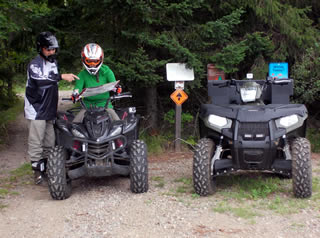
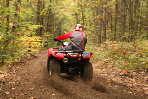
Ashland County ATVing
Ashland County ATV map Please remember not all snowmobile trails are ATV trails.
- Please note that ATVs are not allowed on the 5th Street Corridor in the City of Ashland. For approved ATV routes,
- click here to download the City of Ashland ATV Route Map. This 11″ x 17″ PDF may take a moment to load.
Ashland County ATV are open year round except in the spring. The USDA Forest Service announces annual seasonal trail and road closures to motorized, equestrian and bicycle use in the Chequamegon -Nicolet National Forest Mid April – the beginning of May. https://www.fs.usda.gov/cnnf
If you would like an Ashland County ATV Map mailed to you, please call 715-682-2500 or email fdchamber@visitashland.com.
-
- As a reminder the Tamarack Health WhistleStop Marathon/Half Marathon is run on the East side of the Tri-County Corridor on October 10. That being said the Tri-County corridor will have many runners on October 10th starting east of Iron River (Tri-Lakes Timber Resort area) to Ashland, WI at 8:30am til about 3pm. NOTE: The Tri-County Recreational Corridor, a 62-mile stretch of abandoned railroad right-of-way running from Ashland to Superior, is ALWAYS OPEN.
-
- ATV routes and other trails designated by towns under state law are not affected by seasonal closures. Trail users should check local regulations for trails they plan to use.
-
- There are NO Golf Carts or Go-Carts allowed on any of the trails!!!!!
-
- ATV/UTVs registered in Wisconsin do not require an ATV/UTV trail pass. ATV trail passes for non-residents: $35 yearly or $20 for a 5 day pass. Passes can be purchased at River Rock Inn and Bait Shop and Anglers All.
- For more information check out the Tri-County Corridor Facebook Page.
- The Northwest Wisconsin ATV & Snowmobile Corridor Trail Map features Ashland, Burnett, Douglas, Iron, Rusk, Barron, Chippewa, Washburn, Price, and Sawyer counties. This map will help you plan a trip to Northwest Wisconsin, and individual county maps will help you navigate the trails.
- See for yourself all of the great places you can visit on the seat of an ATV or snowmobile. Click here to view the digital Northwest Wisconsin ATV & Snowmobile Corridor Map. To order your FREE print copy of the Northwest Wisconsin ATV & Snowmobile Corridor Map, click here.
- Click here for the Bayfield Recreation Report.
UTVs
For the most part, utility vehicles (UTVs) can operate on the same trails as ATVs, including the Tri-County Recreational Corridor, but there are some restrictions.
Roadway Operation-ATV/UTV Road Routes
ATV/UTVs can only be driven on County Trunk Highways , such as County F, or designated municipal routes, when those routes are marked with a green sign bearing a white silhouette of an ATV/UTV.
ATV and UTV operators born on or after Jan. 1, 1988, and who are at least 12 years old, must complete an ATV/UTV safety certification course in order to operate on public ATV/UTV trails in Wisconsin. No person under 16 may operate a UTV. Children ages 12-15 must be accompanied by an adult when operating an ATV on road routes. DNR recreational safety specialists recommend all ATV and UTV operators complete a safety course. For more information, visit the DNR website or call the DNR toll-free at 1-888-936-7463. The Wisconsin DNR Call Center is open from 7 a.m. to 10 p.m. seven days a week.
Direct link to the DNR ATV/UTV webpage
Here is a highlight of rules and regulations
- Only ATV’s specifically manufactured to carry two people are allowed to carry passengers. Folks can no longer have passengers on the racks ect. The aftermarket seats that can be attached to the rear rack of an ATV don’t count and ARE NOT eligible to carry a passenger.
- Headlights are required to be on at all times and operators on road routes must operate on the extreme right side of the roadway.
- All passengers in a UTV must wear seat belts.
- Helmets are strongly suggested. Helmets are not required if the person is at least 18 years of age. Children under 18 years of age are required to wear a helmet.
NOTE: There is a 50-inch width restriction on ATVs and 65-inch UTV width restriction within the boundaries of National Forest lands and public ATV trails and routes. Click here for the Wisconsin ATV-UTV regulations.
Dead Horse Slough Trail Head – UTV’s up to 65 inches in width – trail considered a wet trail.
The Dead Horse Slough Trail Head is located on the north side of State Highway 77, next to the Dead Horse Slough. There is a small gravel parking lot for about 6 cars. It is possible to park a trailer in the lot, but turning space is limited.
From Cable, drive east on County Highway M 20 miles to Clam Lake. Turn left (east) on State Highway 77 and drive 2.7 miles to the trailhead.
From Glidden, drive north on State Highway 13 for 3 miles. Turn left (west) on State Highway 77 and travel 11.3 miles to the trailhead.
Click here for a copy of the Dead Horse Run Trail Map.
Dirt bikes
Limited Use Off Highway Motorcycles (OHMs), commonly called Dirt bikes (this means motorized, two-wheeled cycles that are not registered by the Department of Transportation for highway use), are allowed on the Tri-County Corridor during months with no snow. Dirt bikes are never allowed on the county’s designated ATV/UTV or snowmobile trails & road routes. Limited Use OHMs are required to be registered with DNR if they will be used on public trails.The Northwest Wisconsin ATV & Snowmobile Corridor Trail Map features Ashland, Burnett, Douglas, Iron, Rusk, Barron, Chippewa, Washburn, Price, and Sawyer counties. This map will help you plan a trip to Northwest Wisconsin, and individual county maps will help you navigate the trails.
See for yourself all of the great places you can visit on the seat of an ATV or snowmobile. Click here or on the map cover image to the left to view the digital Northwest Wisconsin ATV & Snowmobile Corridor Map. To order your FREE print copy of the Northwest Wisconsin ATV & Snowmobile Corridor Map, click here.
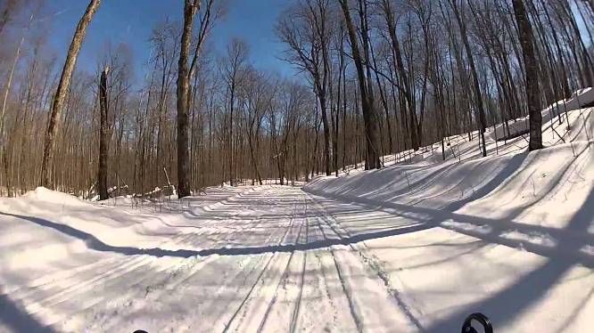
In addition to ATVing we have Snowmobiling !!
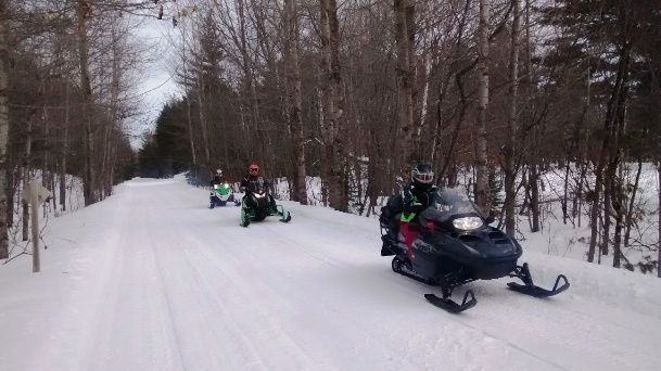 Snowmobiling in Ashland County is always an exciting
Snowmobile Report –March 21, 2026
At midnight 3/21/2026 Ashland County Snowmobile Trails will close for the season. Thanks for the good ride!
One Reroute: starting 1/18 due to logging operations: Trail 11 to Iron County will be detoured. You need to follow Nig Rein Rd to Camp E Rd to reconnect at Bear Track Rd!
Reminder everyone that the Ashland Waterfront Trail is not open to motorized vehicles, including snowmobiles and ATVs. Anyone caught riding on the Ashland Waterfront Trail will be ticketed.
When snowmobiling please stay on the trail. A lot of Ashland County snowmobile trails are on farmers land, be respectful so we don’t lose our easement to their property.
- Snowmobiles may not be modified, or operated, to amplify or otherwise increase the total vehicle noise above the originally manufactured snowmobile noise level. Ashland County Recreation Enforcement. Click here for Bayfield County Trail conditions. As always please follow the snowmobile trail rules and regulations.As always operate with everyone’s safety in mind and report any hazardous trail issues that are observed to the Ashland County Sheriff’s Department (715-682-7023 opt 1) so that it can be forwarded to the appropriate service.The Tri-County Corridor is open from Superior to Ashland. There are still several areas on the eastern end that require attention but all known hazards have been identified and marked. Use caution when approaching ribbons, barricades, and cones.Important reminders: There is no snowmobiling allowed from Ashland to Bad River/Odanah as snowmobiling is not permitted on reservation land. However, snowmobiling is allowed from Bad River east to the Upper Peninsula of Michigan.If you would like to receive an Ashland County Snowmobile map, let us know and we will mail one out to you! Call us at 715/682-2500 or email us fdchamber@visitashland.com.
- Click here for the Ashland County Snowmobile Map.GIS website web map gallery linkClick here for the City of Ashland snowmobile trail routes.Here is a link to Avenza MapsClick here for Bayfield County Trail conditions.
-
Snowmobilers enjoy the well-maintained trails near Clam Lake. Ashland County offers more than 220 miles of groomed snowmobile trails. Wisconsin snowmobile registration will cost $30.00 for three years.
All snowmobiles will be required to have an annual trail pass to operate on a public trail or corridor.
- Trail passes will cost non-club/non-Association of Wisconsin Snowmobile Clubs members $30.00 and can only be purchased through the DNR.
- Members with snowmobiles registered in Wisconsin who belong to both a snowmobile club and the AWSC will be able to buy the trail pass for $10.00.
For more information on the Wisconsin Snowmobile Trail Pass, please visit the AWSC website at www.awsc.org or the DNR website at dnr.wi.gov.
Ashland County Snowmobile Trails traditionally close mid-March if conditions permit they will remain open until March 31st.
Out-of-state snowmobile passes are required for non-residents and can be purchased for $50.00 at the following locations:
ASHLAND
- Anglers All, 2803 E. Lake Shore Drive
- DNR Service Center, 2501 Golf Course Road. https://dnr.wisconsin.gov/permits/registrations/snowmobile/trailpass.html
- River Rock Inn & Bait Shop, 1200 W. Lake Shore Drive
- Walmart Supercenter, Sporting Goods Dept., 2500 E. Lake Shore Drive
CLAM LAKE
- Clam Lake Junction, 60967 State Hwy. 77
BUTTERNUT
- Butternut Feed Store, 121 N. Main Street
GLIDDEN
- Bear Necessities, 171 West Broadway
MELLEN
- Midland Services Mellen, 101 Wilderness Drive
- Northland Foods/Hardware Hank, 108 S. Main Street
And be sure to check the calendar of events on this website for information on our upcoming outdoor events.