Cross-Country Skiing/Snow Shoeing
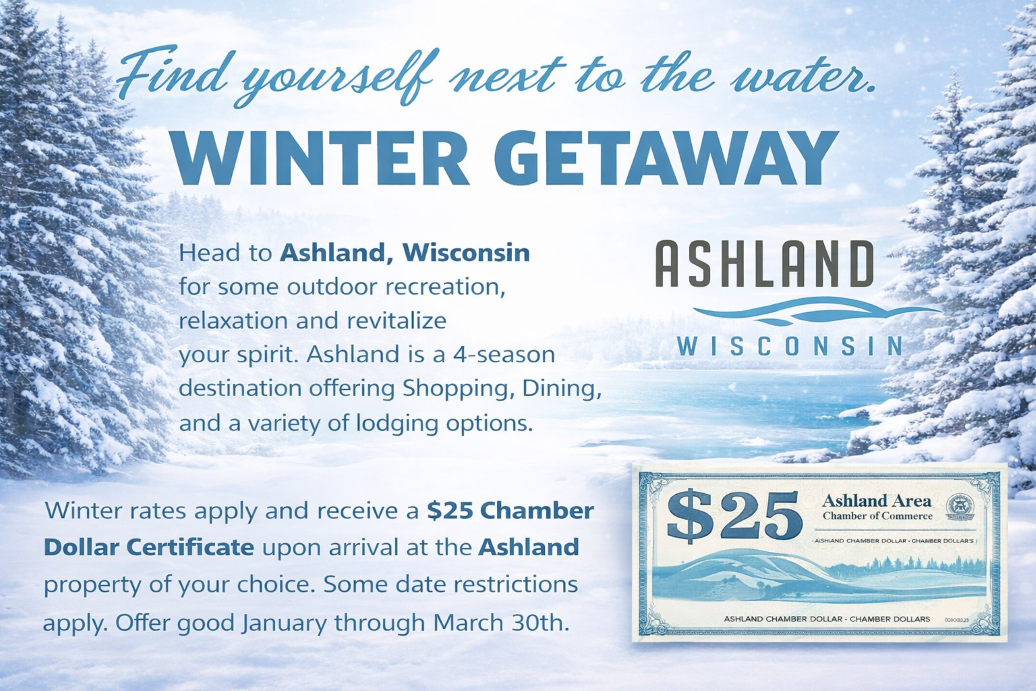 Book your stay in Ashland and receive $25 in Chamber Dollars to spend while you are CROSS COUNTRY SKIING here in Ashland, at any of these Chamber Members. From restaurants to entertainment, retail stores to specialty shops, grocery, gas station to auto repair. All you have to do is once you have booked your stay email us at info@visitashland.com your confirmation and we will have the Chamber Dollars waiting for you at your place of lodging. For more information click here.

Cross Country Skiing: If you didn’t or don’t have your own skis – Solstice Outdoors rents Cross Country Skis
Click the trail name for a printable version of that trail.
Ashland Ski Trails: Most trails provide a combination of skating and classical skiing with two trails for classical only. The trails are gently rolling to flat terrain meandering through pine forest comprising several loops totaling 5 kilometers. Please no snow shoes on the trail – this is a ski trail. The trails are maintained by volunteers. ASTA (Ashland Ski Trail Association) receives no funding from city, state, or federal governments. They ask for a nominal $3.00 donation when using the trail to help continue the operation and maintenance of the trails.
Directions: From U.S. Hwy. 2 turn south on Beaser Avenue. Travel approximately 1 mile to Maple Lane. Turn right on Maple Lane and travel west to the third driveway on the right. Turn right into the parking area.
Conditions: Open 03/13/2026 Late season skiing. Please no snowshoes on the trail. The trail runs entirely on volunteers and donations. $4 per visit or $25 a season. Donations can be left at the trail head or sent via pay pal. Click here for trail conditions.
Chequamegon Bay Golf Club Cross-Country Ski Trail, 3000 Golf Course Road. You can catch the trail just west of the 19th hole (clubhouse). Nestled among the trees and rolling terrain overlooking the Chequamegon Bay of Lake Superior, Chequamegon Bay Golf Club is one of northern Wisconsin’s finest golf challenges. Enjoy some of the area’s most awe-inspiring scenery as you ski this trail.
Conditions: 03/13/2026: Closed! The cross country ski trail at Chequamegon Bay Golf Club is open for both skating and classic. There is a “thin” area marked with orange cones near the bridge crossing on hole #2, so please be aware of this as there are small rocks and bare ground. The trail is being groomed by volunteers and you are skiing at your own risk. Please no dogs or snowshoeing on the trail. Enjoy. After you ski stop into The Local Bar & Grill for a hot or cold drink and some great food. Snow shoeing allowed adjacent to the trail. Enjoy. Friendly reminder – no dogs or snowshoeing on the trail.
Copper Falls State Park: Trails come complete with spectacular river scenery, including copper-colored water and numerous frozen rapids and waterfalls. The park has four classic-only loops, beginner-intermediate, totaling 11.4 km. Copper Falls also boasts two skate/classic combination loops totaling 10.5 km. All of the park’s trails are generally well-groomed and maintained.
Directions: From Ashland, drive south on Hwy. 13 to Mellen. Turn left on Hwy. 169. Follow the signs to the park, approximately 2.5 miles
Conditions: 03/13/2026: Click here for up-to-date trail conditions.
Please remember: Pets are not allowed on the winter trails aside from the 2.5-mile Red Granite Falls trail, where they are welcome as long as they are on a leash and under control.
Penokee Mountain Trail: One-way interconnecting loops in the Chequamegon National Forest. More Difficult/Classical.
Directions: From Ashland, drive south on State Hwy. 13 for 24 miles to Mellen. Turn right (west) on Hwy GG and drive 3 miles to trail.
Conditions: Click here for the most up-to-date trail report.
The main trail runs from Big Bay Road to Middle Road – and the Nucy Meech Trail runs off the main trail. With towering snow covered pines around, it’s a perfect spot for snowshoeing or cross-country skiing at an easy pace.
Directions: The Capser Trail is located about 1/2 mile from the ice road approach – across from the La Pointe Fire Hall on Big Bay Road.
Big Bay State Park:
State Park vehicle stickers or a daily fee is required.
Directions: To get to Big Bay State Park from the ice road approach in La Pointe: Once off the ice road, take a right on Sunny Slope Road and travel approximately .5 miles to Big Bay Road. Take a right on Big Bay Rd. and travel approximately 4 blocks to Middle Road. Take a left on Middle Rd. (will eventually turn into Hagen Road) and follow the State Park signs for approximately 7 miles to the entrance of Big Bay State Park.
Conditions: The trails at Big Bay are all-use and will be packed during the winter but not groomed.
Mt Ashwabay: website www.mtashwabay.org
Mt. Ashwabay offers cross-country skiing in a magnificent setting featuring stunning views of the Apostle Islands National Lakeshore and the Chequamegon National Forest. Cross-country trails cover 30km with ratings from beginner to expert. All trails are groomed and tracked weekly or more frequently as necessary. The cross-country trails are open for snowshoeing, and the same trail fee is good for either XC or snowshoes.
Directions: From Ashland, take U.S. Hwy. 2 west to State Hwy. 13 north. Continue on Hwy. 13 through Washburn, then drive about 10 miles toward Bayfield. Turn left on Ski Hill Road.
Conditions: For the most up-to-date report, check their Facebook page for status updates, https://www.facebook.com/mtashwabay, or call 715/779-3227.
Valhalla Recreation Area– Teuton and Valkyrie Trails: – link works
Valhalla Winter Sports Area is nestled in the Chequamegon National Forest. It offers two systems of cross-country ski trails developed by the U.S. Forest Service and groomed by local volunteers. The three Valkyrie loops run through red and Jack pine forests, with magnificent views of the area on the Sun Bowl Loop. The Teton Ski Trail also features three loops in a mixed birch and maple forest with a roller coaster near the end of Loop B. C Loop is groomed for skating. Valkyrie loops are easy and good for classic and skating. Teuton loops are classic and more difficult.
Directions: Take U.S. Hwy. 2 west. Turn left on Hwy. 13 north. Follow Hwy. 13 for 6.7 miles to County Hwy. C in Washburn. Turn left on Hwy. C and drive 8.5 miles to the trail head.
Snow Conditions: Click here for updated trail reports
FAT BIKE TRAILS:
Mt Ashwabay: Comments: For the most up-to-date report, check their Facebook page for status updates, https://www.mtashwabay.org/fat-bike-conditions, or call 715/779-3227.
The Washburn Ranger District in partnership with the North Coast Cycling Association (NCCA) is allowing fat tire bikes and snowshoes on the left half of the trail tread on Loops A, B and Little A for the Valkyrie Trail System this winter. Under this agreement, NCCA will be hosting events to educate first time users about biking, snowshoeing and winter trail etiquette. Members will also be out on the trails as trail ambassadors to talk with visitors and provide information. Please remember: Snowshoeing, Fat tire bikes and dogs are prohibited on the groomed cross country trails. See the posted instructions at the trail entrances, chalet, warming room, and fee stations.
Snowshoe Trails
Copper Falls State Park: Trails come complete with spectacular river scenery, including copper-colored water and numerous frozen rapids and waterfalls. The park has two loops designated as snowshoe/walking trails totaling 5.5 km. All of the park’s trails are generally well-groomed and maintained.
Directions: From Ashland, drive south on State Hwy. 13 to Mellen. Turn left on Hwy. 169. Follow the signs to the park, approximately 2.5 miles
Conditions: Open on marked trails. Please call 715/274-5123 for the most up-to-date conditions.
NOTE: Hikers and snowshoers are not allowed on designated cross-country ski trails when the trails are snow-covered.
Northern Great Lakes Visitor Center
Snowshoe Trails are open. Northern Great Lakes Visitor Center has snowshoes you can borrow and snowshoe the boardwalk out back and around the grounds.
St. Peter’s Dome is another great place to snowshoe!
The hike to St. Peter’s Dome is 3.6 miles round trip. The trail has moderately steep climbs. It is a good idea to take water along on this hike.
To reach St. Peter’s Dome, cross the log bridge over Morgan Creek where the trail forks and hike up the gradually climbing trail. Soon you will come upon an old campground that was built by the Civilian Conservation Corps in the 1930s. The old brick fireplaces, an artesian well, and a round cistern are all that remain of the campground.
The trail becomes narrow as you walk across much steeper slopes. There is a lake-sized beaver pond to your left. As you continue east, the trail drops in elevation and crosses a rocky streambed.
Beyond the stream the trail becomes steeper and the tread is rocky. In a bit, the grade becomes more gentle and you cross a snowmobile trail. At the base of the granite outcrop that is the dome, you will find a jumble of large broken rock from the quarry.
The trail follows the old road for a hundred feet and then turns left off the road and begins to climb in earnest. After two switchbacks, the trail reaches a grassy opening.
Continue along the trail and climb to the overlook and sheer drop on the north face of St. Peter’s Dome. On a clear day, you can see the Chequamegon Bay of Lake Superior and the Apostle Islands.
Directions: From Ashland, drive south on State Hwy. 13 about 13 miles to County Highway C (about 1 mile south of Marengo). Turn right on Hwy. C and follow it 4.8 miles to Midway Road. Continue straight on Midway Road 1.2 miles to County Line Road (FR 199). Turn left (south) on County Line Road and drive 3.9 miles to the parking lot, which is on the left (east) side of the road.
Conditions: OPEN to snowshoeing as conditions allow.
The Capser Trail on Madeline Island: The main trail runs from Big Bay Road to Middle Road – and the Nucy Meech Trail runs off the main trail. With towering snow-covered pines around, it’s a perfect spot for snowshoeing or cross-country skiing at an easy pace. Directions: The Casper Trail is located about 1/2 mile from the ice road approach – across from the La Pointe Fire Hall on Big Bay Road.
Conditions: OPEN to snowshoeing as conditions allow.
Big Bay State Park: State Park vehicle stickers or a daily fee is required.
Directions: To get to Big Bay State Park from the Ice Road approach in La Pointe: Once off the ice road, take a right on Sunny Slope Road and travel approximately .5 miles to Big Bay Road. Take a right on Big Bay Road and travel approximately 4 blocks to Middle Road. Take a left on Middle Road (will eventually turn into Hagen Road) and follow the State Park signs for approximately 7 miles to the entrance of Big Bay State Park.
Conditions: The trails at Big Bay are all-use and will be packed during the winter but not groomed.
Houghton Falls: To get to Houghton Falls, take U.S. Hwy. 2 to State Hwy. 13 north of Ashland and travel 3.5 miles north of Washburn on Hwy. 13. Turn right on Houghton Falls Road and go 1/2 mile to Houghton Falls Nature Preserve parking lot on your right. There is currently no fee for hiking or parking and pets are allowed if leashed and cleaned up after!
Mt Ashwabay: website www.mtashwabay.org
Mt. Ashwabay offers both cross-country skiing and snowshoeing in a magnificent setting featuring stunning views of the Apostle Islands National Lakeshore and the Chequamegon National Forest. The XC trails are NOT open for snowshoeing, the Fat Tire Trails are. For the most up-to-date report, check their Facebook page for status updates, https://www.facebook.com/mtashwabay, or call 715/779-3227.
Directions: From Ashland, take U.S. Hwy. 2 west to State Hwy. 13 north. Continue on Hwy. 13 through Washburn, then drive about 10 miles toward Bayfield. Turn left on Ski Hill Road. Click here for a PDF version of Cross-Country Skiing and Snowshoe trails.
Downhill Skiing
Mt Ashwabay: 03/13/2026 -Open and grooming!
Conditions: Check their Facebook page for up-to-date information.
RENTALS * Don’t have skis or snowshoes?
- Solstice Outdoors, 2521 W. Lake Shore Drive, 715-682-3590, rents both!
Dog Trail:
Mt. Ashwabay: website Dogs are allowed on some of the trails. Check the website www.mtashwabay.org